Practical Navigation Tips For Bareboaters
By Bob Diamond
©2002
Sailors don’t need to be extremely sophisticated for successful bareboat chartering but companies still have concerns. Although with anchoring, one of the greatest concerns is with navigation. Faulty navigation can cause grounding, occasionally bad enough to result in the total loss of the boat. During the last ten years technological advancements have made both anchoring and navigation easier for bareboat charterers. More mooring buoys in bareboat locations and better windlasses have made anchoring easier. More navigation aids and wide availability of GPS have made navigation easier as well. Even with these advancements, there are still a few losses of boats every year. As rare as these events are and fortunately, human casualties are even rarer, I would like to offer a few practical tips to make navigation easier and safer for bareboat charterers.
Normal bareboat chartering is limited to daytime sailing and is almost always done within sight of land so navigation under these conditions isn’t rocket science. But there are some things you can do to make navigation easier and safer. Following these suggestions will reduce stress and make bare boat cruising more fun as well.
- Take an Approved Navigation Course
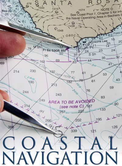
Make sure your knowledge and skills in coastal navigation are up to standard. Courses that teach to a national (or international) standard are offered by ASA and US Sailing schools, The U.S. Coast Guard Auxiliary and U.S. Power Squadrons. The standards set for these courses generally go beyond what you’ll need for bareboat chartering but completion will give you the confidence as well as the tools you’ll need for successful bearboating.
In a typical Coastal Navigation course you can expect to learn to:
- *Identify the chart symbols and explain the terms and characteristics used for navigation aids including shapes, colors, and lights used in the buoyage system
- Identify sources of official publications.
- Select publications required for prudent navigation.
- *Use various instruments for navigation.
- Use the tide and current tables to find times and heights of tides at reference and secondary ports and direction and rate of current at reference and secondary stations.
- *Convert courses and bearings between true, magnetic, and compass.
- Check compass deviation.
- *Plot dead reckoning positions.
- *Plot fixes by various means such as bearings, ranges and distance circles.
- Plot running fixes.
- Determine set, drift and leeway.
- Compensate for the effect of set and drift or leeway.
- Use danger bearings to determine if a vessel is deviating dangerously from a course.
* These are the skills you should be most prepared to use during bareboat charters. Though not everything is on the list is necessarily required during the average bareboat charter cruise, passing such a course confirms a high level of navigational competence that will give the bareboat charter skipper the greatest confidence.
2. Pay Attention at the Chart Briefing

Listen and ask questions at the chart briefing at the beginning of the charter and use your cruising guide during the charter. The folks at the charter company are going to know a lot more about the local sailing area than anyone else and they want you to have a good time. The chart briefing will provide lots of good suggestions about places to go and will also let you know about places that are off limits to the company’s charter boats. Sometimes a “red line” chart is provided to highlight dangerous or off limit areas. Heed the advice at the charter briefing, especially regarding keeping out of certain areas.
3. Use the Cruising Guide

Consult the cruising guide before entering any harbor with which you are not absolutely familiar. The cruising guide describes every harbor, explaining how to approach and pointing out all the hazards. It also provides handy diagrams with GPS coordinates and suggested routes. In addition to vital navigational information, the cruising guide also gives a wealth of information about services, businesses, points of interest, attractions, and background information for the area. Cruising guides as well as nautical charts for bareboat cruising areas are available from charter companies and most retail boating stores.
4. Become Familiar with Navigation Aids
Become familiar with the navigation aid marking system(s) for your chartering location. Charts and cruising guides are available to charterers at home so there’s time to get familiar with the sailing area. There are two world lateral systems and one cardinal system in use:
Lateral System “B” is used in North and South America and the Caribbean. It’s the “red-right-return” system we are familiar with here. The red triangles mark the right hand side of the channel and the green squares mark the left hand side of the channel when returning from the sea.
Lateral System “A” is used in Europe, Africa, Asia and the South Pacific. In this system the red buoys mark the left hand side of the channel when returning from the sea.
5. Bring a Handheld GPS

Different brands and models of GPS have different user interfaces so mastery of one does not mean mastery of all. Good portable and handheld models are inexpensive enough that any charterer can purchase one before a bareboat charter trip. This will allow time to learn the functions and install user waypoints in the particular unit.
Be sure to become familiar with the “GO TO” function. This will tell you the direction to the selected waypoint as well as the direction your boat is tacking. It will also give you course deviation which is how far (and in which direction) your boat has moved from the selected course line. Course deviation is especially valuable when following a course with obstacles on either side. Additionally, the “GO TO” function will tell you how fast you are going and how long it will take to get to your selected waypoint or destination.
This last feature is extremely important. Many anchorages have coral reefs and other obstacles nearby that must be transited in close proximity. Navigation in these areas is done visually by looking through the shallow water to avoid obstacles. This is easy during the mid-day hours when the sun is high enough to allow you to see the bottom. But after about 4:00 PM you can’t see through even shallow water due to the low sun angle. This makes it virtually impossible to see what you’re about to run over. Many accidents have happened because of ill-timed (i.e. late) arrival in areas where it was necessary to navigate visually through shallow water to get to the anchorage.
6. Plan to Arrive Early
if you slow down and are not going to arrive early enough, it’s time to start the engine. Don’t wait until it’s too late to make up for lost progress. Your priority should be to approach an anchorage safely in daylight rather than sailing into the late afternoon or evening hours with the last breath of wind. This is especially important when anchoring in an unfamiliar area or having to secure a mooring buoy where only a few moorings are available. At the chart briefing learn about locations where arriving early is important.
7. Maintain Situational (and Positional) Awareness

This means not only knowing what is going on at the moment, but being aware of what is about to happen.
Is leeway or adverse current taking your boat toward a hazardous area?
Is the bearing to another boat in the distance holding steady indicating the likelihood of a collision course?
Is reduced speed going to cause you to arrive at your destination too late to enter the anchorage safely?
Is there a squall rapidly approaching your position? Is that entire fleet of racing sailboats heading your way?
Are there fish trap boys in your path?
Be aware of what’s going on around you right now and what the situation is going to be in the next 5 to 10 minutes or even more. Keep your mind ahead of the boat in both time and space so no adverse circumstances can sneak up on you and take you by surprise. Remember the old adage: “An excellent sailor is one who uses his expert judgment to avoid situations that require him to use his expert skills”.
8. Never trust just one source of navigational information.
This is doubly important when dealing with information from electric devices, even very good ones like GPS. These devices can be very easy to use but it’s also very easy to occasionally punch a wrong button. Cross check navigational data by observing if the information makes sense and by using other sources of information such as depth soundings, hand bearings and dead reckoning whenever possible.
9. Hold Off Entering Tricky Areas During Squall Activity
Fog can be a problem in non-tropical areas and squalls often reduce visibility in the tropics. Both conditions require more careful navigation than at other times. Even though squalls can reduce visibility to almost nothing, at least they don’t last long. Adjust sail appropriately and put off passage in any narrow or tricky channels while the squall is still blowing. If you’re in the harbor, let the squall blow over before getting underway. If under way, standoff in open water rather than trying to navigate any narrow channels during the school. You normally don’t have to wait long before it becomes warm and clear again.
10. Consider Buddy-Boating or Flotilla Chartering.
Being part of a group can add to your enjoyment and you can learn from other sailors. If you’re not part of a Yacht Club or other privately organized group, there are still ways to get mutual support and enjoy the company of other charters.
Some sailing club/schools offer group flotillas that you can join as individuals, couples or even whole boat loads of cruisers. Many cruises organized by sailing schools offer sailing instruction and even certification during the trip. Flotilla members can get to know each other before the trip, and group organizers go along to make the cruise as enjoyable as possible.
Major charter companies like The Moorings and Sunsail offer flotilla group chartering opportunities where you join the flotilla with your own charter boat. The flotilla is led by captains from the charter company who stay with the fleet and take care of any problems that might arise.
Chartering is a great way to experience the best cruising locations around the world. It’s a lot easier getting to these locations by chartering rather than sailing all the way from home. It’s also cheaper and safer. It’s the only way if you don’t have many months of free time. Just follow good practices seamanship and navigation and you and your shipmates will have a great time and will want to go back again and again.


